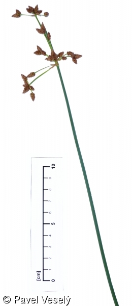
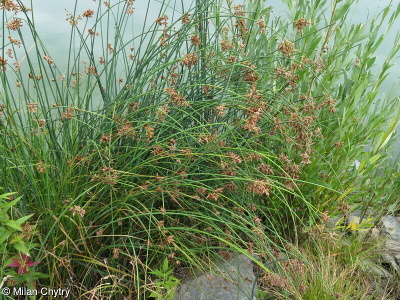
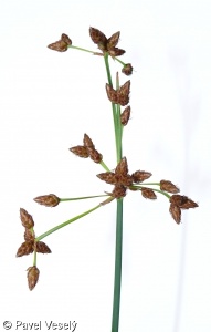
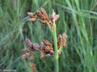
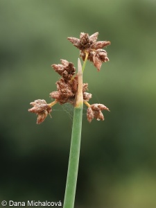
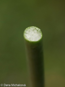
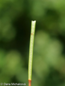
Schoenoplectus lacustris subsp. glaucus
Data
download factsheetHabitus and growth type
-
Plant height [m]: 1.18?
Plant height
Plant height is measured in meters and relates to fully developed mature generative plants growing in the wild. The data were taken preferably from Kleyer et al. (2008), Guarino et al. (2019), Kaplan et al. (2019), French Flora database (2020) and complemented by additional sources such as national and regional floras. Each species is characterized by a mean value calculated across available datasets.
Data source and citation
Axmanová, I. (2022). Plant height. – www.FloraVeg.EU.
Further references
Guarino, R., La Rosa, M. & Pignatti, S. (Eds) (2019). Flora d'Italia, volume 4. Bologna: Edagricole.
French Flora database (baseflor), project of Flore et végétation de la France et du Monde: CATMINAT. Available at http://philippe.julve.pagesperso-orange.fr/catminat.htm [accessed June 2020]
Kaplan, Z., Danihelka, J., Chrtek, J. Jr., Kirschner, J., Kubát, K., Štěpánek, J. & Štech, M. (Eds) (2019). Klíč ke květeně České republiky [Key to the flora of the Czech Republic]. Ed. 2. Praha: Academia.
Kleyer, M., Bekker, R. M., Knevel, I. C., Bakker, J. P., Thompson, K., Sonnenschein, M., … Peco, B. (2008). The LEDA Traitbase: A database of life-history traits of the Northwest European flora. Journal of Ecology, 96(6), 1266–1274. https://doi.org/10.1111/j.1365-2745.2008.01430.x
Leaf
-
Specific leaf area [mm2/mg]: 5.42?
Specific leaf area
Specific leaf area (SLA) is the ratio of leaf area to leaf dry mass expressed in mm2 mg-1, reflecting the amount of energy plants invest in their leaf biomass. SLA is related to plant growth strategy with respect to water availability and temperature. The data were taken preferably from Kleyer et al. (2008), Tavşanoğlu & Pausas (2018), Ladouceur et al. (2019) and complemented by additional sources. Each species is characterized by a mean value calculated across available datasets.
Data source and citation
Axmanová, I. (2022). Specific leaf area. – www.FloraVeg.EU.
Further references
Kleyer, M., Bekker, R. M., Knevel, I. C., Bakker, J. P., Thompson, K., Sonnenschein, M., … Peco, B. (2008). The LEDA Traitbase: A database of life-history traits of the Northwest European flora. Journal of Ecology, 96(6), 1266–1274. https://doi.org/10.1111/j.1365-2745.2008.01430.x
Ladouceur, E., Bonomi, C., Bruelheide, H., Klimešová, J., Burrascano, S., Poschlod, P., … Jiménez-Alfaro, B. (2019). The functional trait spectrum of European temperate grasslands. Journal of Vegetation Science, 30(5), 777–788. https://doi.org/10.1111/jvs.12784
Tavşanoğlu, Ç., & Pausas, J. (2018). A functional trait database for Mediterranean Basin plants. Scientific data, 5, 180135. https://doi.org/10.1038/sdata.2018.135
Flower
-
Flowering period: April-August?
Flowering period
The months of the beginning and end of flowering across Europe are given. The data were compiled from Kaplan et al. 2019, French Flora database and Guarino et al. 2019. For each species, we provide a maximal flowering range across available sources.
Data source and citation
Axmanová, I. (2022). Flowering period. – www.FloraVeg.EU.
Further references
Guarino, R., La Rosa, M. & Pignatti, S. (Eds) (2019). Flora d'Italia, volume 4. Bologna: Edagricole.
GreekFlora.gr. Available at https://www.greekflora.gr/ [accessed June 2020]
French Flora database (baseflor), project of Flore et végétation de la France et du Monde: CATMINAT. Available at http://philippe.julve.pagesperso-orange.fr/catminat.htm [accessed June 2020]
Kaplan Z., Danihelka J., Chrtek J. Jr., Kirschner J., Kubát K., Štěpánek J. & Štech M. (eds) (2019) Klíč ke květeně České republiky [Key to the flora of the Czech Republic]. Ed. 2. – Academia, Praha.
Ladouceur, E., Bonomi, C., Bruelheide, H., Klimešová, J., Burrascano, S., Poschlod, P., … Jiménez-Alfaro, B. (2019). The functional trait spectrum of European temperate grasslands. Journal of Vegetation Science, 30(5), 777–788. https://doi.org/10.1111/jvs.12784
Săvulescu, T. (Ed.) (1952–1976). Flora Republicii Populare Române – Flora Republicii Socialiste România. Vols 1–13. București: Editura Academiei Republicii Populare Române, Academia Republicii Socialiste România.
Fruit, seed and dispersal
-
Seed mass [mg]: 1.54?
Seed mass
Seed mass represent the mean weight of 1000 seeds in a dry state, measured in grams. The data were taken preferably from Kleyer et al. (2008), Hintze et al. (2013), García-Gutiérrez et al. (2018) and Seed Information Database (Royal Botanic Gardens Kew 2021) and complemented by additional sources such as national and regional floras. Each species is characterized by a mean value calculated across available datasets. Upon request, minimum, maximum and median values are also available.
Data source and citation
Axmanová, I. (2022). Seed mass. – www.FloraVeg.EU.
Further references
García-Gutiérrez, T., Jiménez-Alfaro, B., Fernández-Pascual, E., & Müller, J. V. (2018). Functional diversity and ecological requirements of alpine vegetation types in a biogeographical transition zone. Phytocoenologia, 77–89. https://doi.org/10.1127/phyto/2017/0224
Hintze, C., Heydel, F., Hoppe, C., Cunze, S., König, A., & Tackenberg, O. (2013). D3: The Dispersal and Diaspore Database – Baseline data and statistics on seed dispersal. Perspectives in Plant Ecology, Evolution and Systematics, 15(3), 180–192. https://doi.org/10.1016/j.ppees.2013.02.001
Kleyer, M., Bekker, R. M., Knevel, I. C., Bakker, J. P., Thompson, K., Sonnenschein, M., … Peco, B. (2008). The LEDA Traitbase: A database of life-history traits of the Northwest European flora. Journal of Ecology, 96(6), 1266–1274. https://doi.org/10.1111/j.1365-2745.2008.01430.x
Royal Botanic Gardens Kew. (2021). Seed Information Database (SID). Version 7.1. Available at: http://data.kew.org/sid/ [accessed May 2021] -
Dispersal mode: Local non-specific dispersal?
Dispersal mode
Dispersal mode (dispersal syndrome, dispersal type) characterizes plant dispersal ability. It is represented by following categories: (i) local non-specific dispersal, which combines self-dispersal (autochory) and dispersal initiated by wind, where diaspores do not have any efficient special dispersal features, including several dispersal modes (namely ballochory, blastochory, boleochory, barochory); (ii) myrmecochory (ant dispersal); (iii) wind dispersal (anemochory), diaspores have special dispersal features such as hem, pappus, trichomes, dusty seeds or the species are tumbleweeds; (iv) animal dispersal includes dyszoochory, i.e. diaspores foraged by animals, which sometimes hide them as stock; (v) endozoochory, i.e. dispersal in animal gastrointestinal tract, and (vi) epizoochory, i.e., dispersal of diaspores attached on animal fur; special case is the (vii) anthropochory, i.e. human dispersal and (viii) hydrochory (water dispersal). Please note that hydrochory is not considered in the dispersal distance classes classification.
The dispersal modes are mainly estimated from species' morphological characteristics.
Categories
- Local non-specific dispersal
- Myrmecochory
- Anemochory
- Dyszoochory
- Endozoochory
- Epizoochory
- Anthropochory
- Hydrochory
Data source and citation
Lososová Z., Axmanová I., Chytrý M., Midolo G., Abdulhak S., Karger D.N., Renaud J., Van Es J., Vittoz P. & Thuiller W. (2023). Seed dispersal distance classes and dispersal modes for the European flora. Global Ecology and Biogeography, 32(9), 1485–1494.
Further references
Vittoz P. & Engler R. (2007). Seed dispersal distances: a typology based on dispersal modes and plant traits. Botanica Helvetica, 117, 109–124.
-
Dispersal distance class: 2?
Dispersal distance class
Dispersal distance classes are represented by ordered classes from 1 to 7, where classes 1 to 6 represent a gradient from short-distance dispersal to long-scale dispersal. The last class represents the dispersal mediated by humans. For species of the last class the assignment to the previous six classes and natural dispersal mode are given. The assignment of individual plants follows Lososová et al. (2023), a dataset prepared using the adjusted methodology of Vittoz & Engler (2007).
To assign plants into dispersal distance classes, several plant characteristics were obtained from various sources, namely plant height, life form, predominant dispersal mode, seed mass, typical habitat, plant geographical origin and information on dispersal by humans. In contrast to the original approach of Vittoz & Engler (2007), definitions of the dispersal distance classes were slightly modified.
Class 1 contains species shorter than 0.3 m. Their seeds do not have any specific dispersal features. Species are mostly self-dispersed, although seed dispersal can be initiated by wind, e.g., by shaking the fruit, which causes the diaspore to fall down. Class 2 is the most species-rich, including species with non-specific local dispersal strategy taller than 0.3 m. Class 3 includes ant-dispersed (myrmecochorous) species and wind-dispersed (anemochorous) forest herbs and dwarf shrubs. Class 4 is the least species-rich, including less efficient wind-dispersed woody plants and tumbleweeds. Class 5 includes wind-dispersed herbs and shrubs of open habitats and wind-dispersed trees with more efficient dispersal units (with trichomes). Class 6 includes species with different modes of animal dispersal. They can be dyszoochorous (i.e., foraged by animals, which sometimes hide them as stock), endozoochorous (i.e., dispersal in animal gastrointestinal tract), and epizoochorous (i.e., dispersal on animal fur). Finally, class 7 contains human-dispersed (antropochorous) species.
The species of the last class are also classified into one of the previous six classes based on their natural dispersal mode. Only classes 1-6 can be used in studies at the landscape scale where it is assumed that most species disperse naturally. All seven classes can be used in studies at a broader geographical scale where rare events of long-distance human dispersal are important.
Classes
- Class 1. Small plants without any specific dispersal features. Mean dispersal distance: 0.1–1 m.
- Class 2. Tall plants without any specific dispersal features. Mean dispersal distance: 1–5 m.
- Class 3. Wind-dispersed plants of forest understorey and ant-dispersed plants. Mean dispersal distance: 2–15 m.
- Class 4. Tumbleweed and wind dispersed trees and shrubs without trichomes. Mean dispersal distance: 40–150 m.
- Class 5. Wind dispersed trees and shrubs with trichomes and wind dispersal plants of open habitats. Mean dispersal distance: 10–500 m.
- Class 6. Animal dispersed plants. Mean dispersal distance: 400–1500 m.
- Class 7. Human dispersed plants. Mean dispersal distance: 500 –5000 m.
Data source and citation
Lososová Z., Axmanová I., Chytrý M., Midolo G., Abdulhak S., Karger D.N., Renaud J., Van Es J., Vittoz P. & Thuiller W. (2023). Seed dispersal distance classes and dispersal modes for the European flora. Global Ecology and Biogeography, 32(9), 1485–1494.
Further references
Vittoz P. & Engler R. (2007). Seed dispersal distances: a typology based on dispersal modes and plant traits. Botanica Helvetica, 117, 109–124.
Ecology
-
Disturbance indicator values
-
Disturbance frequency: 1.83?
Disturbance frequency
Following Midolo et al. (2023), the indicator value for disturbance frequency is expressed as the log10 mean inverse of return time (in centuries) of disturbance, which is the mean interval between successive disturbance events. Disturbance frequency refers to all possible types of disturbance that may occur in a given habitat, including anthropogenic and natural disturbance as well as grazing and mowing. Because one habitat can be affected by more than one disturbance type, disturbance frequency values were estimated for the most important disturbance types characterizing each habitat. Data are reported as separate values for disturbance affecting the whole plant community (including all vegetation layers) and values considering the herb layer only. This separation accounts for the fact that disturbance regimes in the tree and shrub layers differ in severity and frequency from the disturbance regimes in the herb layer of the same community. For habitats with herbaceous vegetation only, the whole-community values are equal to the herb-layer values.
Data source and citation
Midolo G., Herben T., Axmanová I., Marcenò C., Pätsch R., Bruelheide H., ... & Chytrý M. (2023). Disturbance indicator values for European plants. Global Ecology and Biogeography, 32, 24–34. https://doi.org/10.1111/GEB.13603
Further references
Herben, T., Chytrý, M., & Klimešová, J. (2016). A quest for species‐level indicator values for disturbance. Journal of Vegetation Science, 27(3), 628-636. https://doi.org/10.1111/jvs.12384>
Herben, T., Klimešová, J., & Chytrý, M. (2018). Effects of disturbance frequency and severity on plant traits: an assessment across a temperate flora. Functional Ecology, 32(3), 799-808. https://doi.org/10.1111/1365-2435.13011> -
Disturbance frequency (herb layer): 1.9?
Disturbance frequency (herb layer)
Following Midolo et al. (2023), the indicator value for disturbance frequency is expressed as the log10 mean inverse of return time (in centuries) of disturbance, which is the mean interval between successive disturbance events. Disturbance frequency refers to all possible types of disturbance that may occur in a given habitat, including anthropogenic and natural disturbance as well as grazing and mowing. Because one habitat can be affected by more than one disturbance type, disturbance frequency values were estimated for the most important disturbance types characterizing each habitat. Data are reported as separate values for disturbance affecting the whole plant community (including all vegetation layers) and values considering the herb layer only. This separation accounts for the fact that disturbance regimes in the tree and shrub layers differ in severity and frequency from the disturbance regimes in the herb layer of the same community. For habitats with herbaceous vegetation only, the whole-community values are equal to the herb-layer values.
Data source and citation
Midolo G., Herben T., Axmanová I., Marcenò C., Pätsch R., Bruelheide H., ... & Chytrý M. (2023). Disturbance indicator values for European plants. Global Ecology and Biogeography, 32, 24–34. https://doi.org/10.1111/GEB.13603
Further references
Herben, T., Chytrý, M., & Klimešová, J. (2016). A quest for species‐level indicator values for disturbance. Journal of Vegetation Science, 27(3), 628-636. https://doi.org/10.1111/jvs.12384>
Herben, T., Klimešová, J., & Chytrý, M. (2018). Effects of disturbance frequency and severity on plant traits: an assessment across a temperate flora. Functional Ecology, 32(3), 799-808. https://doi.org/10.1111/1365-2435.13011> -
Disturbance severity: 0.34?
Disturbance severity
Following Midolo et al. (2023), the indicator value for disturbance severity is expressed as a continuous value ranging from 0 (no change in biomass) to 1 (complete loss of plant cover). Disturbance severity refers to all possible types of disturbance that may occur in a given habitat, including anthropogenic and natural disturbance as well as grazing and mowing. Because one habitat can be affected by more than one disturbance type, disturbance severity values were estimated for the most important disturbance types characterizing each habitat. Data are reported as separate values for disturbance affecting the whole plant community (including all vegetation layers) and values considering the herb layer only. This separation accounts for the fact that disturbance regimes in the tree and shrub layers differ in severity and frequency from the disturbance regimes in the herb layer of the same community. For habitats with herbaceous vegetation only, the whole-community values are equal to the herb-layer values.
Data source and citation
Midolo G., Herben T., Axmanová I., Marcenò C., Pätsch R., Bruelheide H., ... & Chytrý M. (2023). Disturbance indicator values for European plants. Global Ecology and Biogeography, 32, 24–34. https://doi.org/10.1111/GEB.13603
Further references
Herben, T., Chytrý, M., & Klimešová, J. (2016). A quest for species‐level indicator values for disturbance. Journal of Vegetation Science, 27(3), 628-636. https://doi.org/10.1111/jvs.12384>
Herben, T., Klimešová, J., & Chytrý, M. (2018). Effects of disturbance frequency and severity on plant traits: an assessment across a temperate flora. Functional Ecology, 32(3), 799-808. https://doi.org/10.1111/1365-2435.13011> -
Disturbance severity (herb layer): 0.34?
Disturbance severity (herb layer)
Following Midolo et al. (2023), the indicator value for disturbance severity is expressed as a continuous value ranging from 0 (no change in biomass) to 1 (complete loss of plant cover). Disturbance severity refers to all possible types of disturbance that may occur in a given habitat, including anthropogenic and natural disturbance as well as grazing and mowing. Because one habitat can be affected by more than one disturbance type, disturbance severity values were estimated for the most important disturbance types characterizing each habitat. Data are reported as separate values for disturbance affecting the whole plant community (including all vegetation layers) and values considering the herb layer only. This separation accounts for the fact that disturbance regimes in the tree and shrub layers differ in severity and frequency from the disturbance regimes in the herb layer of the same community. For habitats with herbaceous vegetation only, the whole-community values are equal to the herb-layer values.
Data source and citation
Midolo G., Herben T., Axmanová I., Marcenò C., Pätsch R., Bruelheide H., ... & Chytrý M. (2023). Disturbance indicator values for European plants. Global Ecology and Biogeography, 32, 24–34. https://doi.org/10.1111/GEB.13603
Further references
Herben, T., Chytrý, M., & Klimešová, J. (2016). A quest for species‐level indicator values for disturbance. Journal of Vegetation Science, 27(3), 628-636. https://doi.org/10.1111/jvs.12384>
Herben, T., Klimešová, J., & Chytrý, M. (2018). Effects of disturbance frequency and severity on plant traits: an assessment across a temperate flora. Functional Ecology, 32(3), 799-808. https://doi.org/10.1111/1365-2435.13011> -
Mowing frequency: 0.45?
Mowing frequency
Following Midolo et al. (2023), the indicator value for mowing frequency is expressed as the log10 mean inverse of return time (in centuries) of disturbance, which is the mean interval between successive mowing events.
Data source and citation
Midolo G., Herben T., Axmanová I., Marcenò C., Pätsch R., Bruelheide H., ... & Chytrý M. (2023). Disturbance indicator values for European plants. Global Ecology and Biogeography, 32, 24–34. https://doi.org/10.1111/GEB.13603
Further references
Herben, T., Chytrý, M., & Klimešová, J. (2016). A quest for species‐level indicator values for disturbance. Journal of Vegetation Science, 27(3), 628-636. https://doi.org/10.1111/jvs.12384>
Herben, T., Klimešová, J., & Chytrý, M. (2018). Effects of disturbance frequency and severity on plant traits: an assessment across a temperate flora. Functional Ecology, 32(3), 799-808. https://doi.org/10.1111/1365-2435.13011> -
Grazing pressure: 0.25?
Grazing pressure
Following Midolo et al. (2023), the indicator value for grazing pressure is expressed as a continuous value ranging from 0 (no change in biomass) to 1 (complete loss of plant cover) caused by grazing.
Data source and citation
Midolo G., Herben T., Axmanová I., Marcenò C., Pätsch R., Bruelheide H., ... & Chytrý M. (2023). Disturbance indicator values for European plants. Global Ecology and Biogeography, 32, 24–34. https://doi.org/10.1111/GEB.13603
Further references
Herben, T., Chytrý, M., & Klimešová, J. (2016). A quest for species‐level indicator values for disturbance. Journal of Vegetation Science, 27(3), 628-636. https://doi.org/10.1111/jvs.12384>
Herben, T., Klimešová, J., & Chytrý, M. (2018). Effects of disturbance frequency and severity on plant traits: an assessment across a temperate flora. Functional Ecology, 32(3), 799-808. https://doi.org/10.1111/1365-2435.13011> -
Soil disturbance: 0.14?
Soil disturbance
Following Midolo et al. (2023), the indicator value for soil distuance is expressed as a continuous value ranging from 0 (no change in biomass) to 1 (complete loss of plant cover) caused by factor causing plant biomass death/removal from soil turning and furrowing.
Data source and citation
Midolo G., Herben T., Axmanová I., Marcenò C., Pätsch R., Bruelheide H., ... & Chytrý M. (2023). Disturbance indicator values for European plants. Global Ecology and Biogeography, 32, 24–34. https://doi.org/10.1111/GEB.13603
Further references
Herben, T., Chytrý, M., & Klimešová, J. (2016). A quest for species‐level indicator values for disturbance. Journal of Vegetation Science, 27(3), 628-636. https://doi.org/10.1111/jvs.12384>
Herben, T., Klimešová, J., & Chytrý, M. (2018). Effects of disturbance frequency and severity on plant traits: an assessment across a temperate flora. Functional Ecology, 32(3), 799-808. https://doi.org/10.1111/1365-2435.13011>
Habitat and sociology
-
Syntaxon
-
?
Diagnostic species of phytosociological classes
Diagnostic species are characterized by a concentration of their occurrence in the stands belonging to the target vegetation unit while being rare or absent in other vegetation units. For the European vegetation classes of the EuroVegChecklist (Mucina et al. 2016), the list of these species was compiled from various European literature sources, especially syntaxonomic monographs and revisions containing extensive synthetic phytosociological tables. Expert opinion from EuroVegChecklist authors was used to judge problematic cases. Some species were assigned to more than one class. Unlike for the EUNIS habitat types, no statistical approach was used to determine diagnostic species for European vegetation classes.
Data source and citation
Mucina L., Bültmann H., Dierßen K., Theurillat J.-P., Raus T., Čarni A., … Tichý L. (2016). Vegetation of Europe: Hierarchical floristic classification system of vascular plant, bryophyte, lichen, and algal communities. Applied Vegetation Science, 19(Suppl. 1), 3–264. https://doi.org/10.1111/avsc.12257 (Mucina et al. 2016, version 3, 2024-01-01)
-
EUNIS habitat
-
Diagnostic species of EUNIS habitats: Q46 Carpathian travertine fen with halophytes, Q54 Inland saline or brackish helophyte bed?
Diagnostic species of EUNIS habitats
Diagnostic species are characterized by a concentration of their occurrence in the stands belonging to the target habitat type while being rare or absent in other habitat types. For the habitat types of the EUNIS classification (Chytrý et al. 2020), these species were determined based on the calculation of fidelity of each species to a group of vegetation plots representing the target habitat type in a geographically and ecologically stratified selection of plots from the European Vegetation Archive (Chytrý et al. 2016). Fidelity was calculated using the phi coefficient of association (Sokal & Rohlf, 1995; Chytrý et al., 2002) standardized as if each habitat was represented by the same number of plots (Tichý & Chytrý, 2006). The species with a value of phi greater than 0.15 for a particular habitat were considered as diagnostic for this habitat. The statistical significance of the species–habitat association was tested using Fisher's exact test (Sokal & Rohlf, 1995), and if not significant at p < 0.05, the species was excluded from the list of diagnostic species (Tichý & Chytrý, 2006).
Categories
- MA211 Arctic coastal saltmarsh
- MA221 Atlantic saltmarsh driftline
- MA222 Atlantic upper saltmarsh
- MA223 Atlantic upper-mid saltmarsh and saline and brackish reed, rush and sedge bed
- MA224 Atlantic mid-low saltmarsh
- MA225 Atlantic pioneer saltmarsh
- MA232 Baltic coastal meadow
- MA241 Black Sea littoral saltmarsh
- MA251 Mediterranean upper saltmarsh
- MA252 Mediterranean upper-mid saltmarsh and saline and brackish reed, rush and sedge bed
- MA253 Mediterranean mid-low saltmarsh
- N11 Atlantic, Baltic and Arctic sand beach
- N12 Mediterranean and Black Sea sand beach
- N13 Atlantic and Baltic shifting coastal dune
- N14 Mediterranean, Macaronesian and Black Sea shifting coastal dune
- N15 Atlantic and Baltic coastal dune grassland (grey dune)
- N16 Mediterranean and Macaronesian coastal dune grassland (grey dune)
- N17 Black Sea coastal dune grassland (grey dune)
- N18 Atlantic and Baltic coastal Empetrum heath
- N19 Atlantic coastal Calluna and Ulex heath
- N1A Atlantic and Baltic coastal dune scrub
- N1B Mediterranean and Black Sea coastal dune scrub
- N1C Macaronesian coastal dune scrub
- N1D Atlantic and Baltic broad-leaved coastal dune forest
- N1E Black Sea broad-leaved coastal dune forest
- N1F Baltic coniferous coastal dune forest
- N1G Mediterranean coniferous coastal dune forest
- N1H Atlantic and Baltic moist and wet dune slack
- N1J Mediterranean and Black Sea moist and wet dune slack
- N21 Atlantic, Baltic and Arctic coastal shingle beach
- N22 Mediterranean and Black Sea coastal shingle beach
- N31 Atlantic and Baltic rocky sea cliff and shore
- N32 Mediterranean and Black Sea rocky sea cliff and shore
- N33 Macaronesian rocky sea cliff and shore
- N34 Atlantic and Baltic soft sea cliff
- N35 Mediterranean and Black Sea soft sea cliff
- P2N Spring
- P3a Brackish-water vegetation
- P3b Fresh-water small pleustophyte vegetation
- P3c Fresh-water large pleustophyte vegetation
- P3d Fresh-water submerged vegetation
- P3e Fresh-water nymphaeid vegetation
- P3f Oligotrophic-water vegetation
- P3g Dystrophic-water vegetation
- P3h Stonewort vegetation
- Q11 Raised bog
- Q12 Blanket bog
- Q21 Oceanic valley mire
- Q22 Poor fen
- Q23 Relict mire of Mediterranean mountains
- Q24 Intermediate fen and soft-water spring mire
- Q25 Non-calcareous quaking mire
- Q31 Palsa mire
- Q41 Alkaline, calcareous, carbonate-rich small-sedge spring fen
- Q42 Extremely rich moss-sedge fen
- Q43 Tall-sedge base-rich fen
- Q44 Calcareous quaking mire
- Q45 Arctic-alpine rich fen
- Q46 Carpathian travertine fen with halophytes
- Q51 Tall-helophyte bed
- Q52 Small-helophyte bed
- Q53 Tall-sedge bed
- Q54 Inland saline or brackish helophyte bed
- Q61 Periodically exposed shore with stable, eutrophic sediments with pioneer or ephemeral vegetation
- Q62 Periodically exposed shore with stable, mesotrophic sediments with pioneer or ephemeral vegetation
- Q63 Periodically exposed saline shore with pioneer or ephemeral vegetation
- R11 Pannonian and Pontic sandy steppe
- R12 Cryptogam- and annual-dominated vegetation on siliceous rock outcrops
- R13 Cryptogam- and annual-dominated vegetation on calcareous and ultramafic rock outcrops
- R14 Perennial rocky grassland of the Italian Peninsula
- R15 Continental dry rocky steppic grassland and dwarf scrub on chalk outcrops
- R16 Perennial rocky grassland of Central and South-Eastern Europe
- R17 Heavy-metal dry grassland of the Balkans
- R18 Perennial rocky calcareous grassland of subatlantic-submediterranean Europe
- R19 Dry steppic submediterranean pasture of the Amphi-Adriatic region
- R1A Semi-dry perennial calcareous grassland (meadow steppe)
- R1B Continental dry grassland (true steppe)
- R1C Desert steppe
- R1D Mediterranean closely grazed dry grassland
- R1E Mediterranean tall perennial dry grassland
- R1F Mediterranean annual-rich dry grassland
- R1G Iberian oromediterranean siliceous dry grassland
- R1H Iberian oromediterranean basiphilous dry grassland
- R1J Cyrno-Sardean oromediterranean siliceous dry grassland
- R1K Balkan and Anatolian oromediterranean dry grassland
- R1L Madeiran oromediterranean siliceous dry grassland
- R1M Lowland to montane, dry to mesic grassland usually dominated by Nardus stricta
- R1N Open Iberian supramediterranean dry acid and neutral grassland
- R1P Oceanic to subcontinental inland sand grassland on dry acid and neutral soils
- R1Q Inland sanddrift and dune with siliceous grassland
- R1R Mediterranean to Atlantic open, dry, acid and neutral grassland
- R1S Heavy-metal grassland in Western and Central Europe
- R1T Azorean open, dry, acid to neutral grassland
- R21 Mesic permanent pasture of lowlands and mountains
- R22 Low and medium altitude hay meadow
- R23 Mountain hay meadow
- R24 Iberian summer pasture (vallicar)
- R31 Mediterranean tall humid inland grassland
- R32 Mediterranean short moist grassland of lowlands
- R33 Mediterranean short moist grassland of mountains
- R34 Submediterranean moist meadow
- R35 Moist or wet mesotrophic to eutrophic hay meadow
- R36 Moist or wet mesotrophic to eutrophic pasture
- R37 Temperate and boreal moist or wet oligotrophic grassland
- R41 Snow-bed vegetation
- R42 Boreal and Arctic acidophilous alpine grassland
- R43 Temperate acidophilous alpine grassland
- R44 Arctic-alpine calcareous grassland
- R45 Alpine and subalpine calcareous grassland of the Balkans and Apennines
- R51 Thermophilous forest fringe of base-rich soils
- R52 Forest fringe of acidic nutrient-poor soils
- R53 Macaronesian thermophilous forest fringe
- R54 Pteridium aquilinum vegetation
- R55 Lowland moist or wet tall-herb and fern fringe
- R56 Montane to subalpine moist or wet tall-herb and fern fringe
- R57 Herbaceous forest clearing vegetation
- R61 Mediterranean inland salt steppe
- R62 Continental inland salt steppe
- R63 Temperate inland salt marsh
- R64 Semi-desert salt pan
- R65 Continental subsaline alluvial pasture and meadow
- S11 Shrub tundra
- S12 Moss and lichen tundra
- S21 Subarctic and alpine dwarf Salix scrub
- S22 Alpine and subalpine ericoid heath
- S23 Alpine and subalpine Juniperus scrub
- S24 Subalpine genistoid scrub of the Amphi-Adriatic region
- S25 Subalpine and subarctic deciduous scrub
- S26 Subalpine Pinus mugo scrub
- S31 Lowland to montane temperate and submediterranean Juniperus scrub
- S32 Temperate Rubus scrub
- S33 Lowland to montane temperate and submediterranean genistoid scrub
- S34 Balkan-Anatolian submontane genistoid scrub
- S35 Temperate and submediterranean thorn scrub
- S36 Low steppic scrub
- S37 Corylus avellana scrub
- S38 Temperate forest clearing scrub
- S41 Wet heath
- S42 Dry heath
- S43 Macaronesian heath
- S51 Mediterranean maquis and arborescent matorral
- S52 Submediterranean pseudomaquis
- S53 Spartium junceum scrub
- S54 Thermomediterranean arid scrub
- S61 Western basiphilous garrigue
- S62 Western acidophilous garrigue
- S63 Eastern garrigue
- S64 Macaronesian garrigue
- S65 Mediterranean gypsum scrub
- S66 Mediterranean halo-nitrophilous scrub
- S67 Aralo-Caspian semi-desert
- S68 Semi-desert sand dune with sparse scrub
- S71 Western Mediterranean spiny heath
- S72 Eastern Mediterranean spiny heath (phrygana)
- S73 Western Mediterranean mountain hedgehog-heath
- S74 Central Mediterranean mountain hedgehog-heath
- S75 Eastern Mediterranean mountain hedgehog-heath
- S76 Canarian mountain hedgehog-heath
- S81 Canarian xerophytic scrub
- S82 Madeiran xerophytic scrub
- S91 Temperate riparian scrub
- S92 Salix fen scrub
- S93 Mediterranean riparian scrub
- S94 Semi-desert riparian scrub
- T11 Temperate Salix and Populus riparian forest
- T12 Alnus glutinosa-Alnus incana forest on riparian and mineral soils
- T13 Temperate hardwood riparian forest
- T14 Mediterranean and Macaronesian riparian forest
- T15 Broadleaved swamp forest on non-acid peat
- T16 Broadleaved mire forest on acid peat
- T17 Fagus forest on non-acid soils
- T18 Fagus forest on acid soils
- T19 Temperate and submediterranean thermophilous deciduous forest
- T1A Mediterranean thermophilous deciduous forest
- T1B Acidophilous Quercus forest
- T1C Temperate and boreal mountain Betula and Populus tremula forest on mineral soils
- T1D Southern European mountain Betula and Populus tremula forest on mineral soils
- T1E Carpinus and Quercus mesic deciduous forest
- T1F Ravine forest
- T1G Alnus cordata forest
- T1H Broadleaved deciduous plantation of non site-native trees
- T21 Mediterranean evergreen Quercus forest
- T22 Mainland laurophyllous forest
- T23 Macaronesian laurophyllous forest
- T24 Olea europaea-Ceratonia siliqua forest
- T25 Phoenix theophrasti vegetation
- T26 Phoenix canariensis vegetation
- T27 Ilex aquifolium forest
- T28 Macaronesian heathy forest
- T29 Broadleaved evergreen plantation of non site-native trees
- T31 Temperate mountain Picea forest
- T32 Temperate mountain Abies forest
- T33 Mediterranean mountain Abies forest
- T34 Temperate subalpine Larix, Pinus cembra and Pinus uncinata forest
- T35 Temperate continental Pinus sylvestris forest
- T36 Temperate and submediterranean montane Pinus sylvestris-Pinus nigra forest
- T37 Mediterranean montane Pinus sylvestris-Pinus nigra forest
- T38 Mediterranean montane Cedrus forest
- T39 Mediterranean and Balkan subalpine Pinus heldreichii-Pinus peuce forest
- T3A Mediterranean lowland to submontane Pinus forest
- T3B Pinus canariensis forest
- T3C Taxus baccata forest
- T3D Mediterranean Cupressaceae forest
- T3E Macaronesian Juniperus forest
- T3F Dark taiga
- T3G Pinus sylvestris light taiga
- T3H Larix light taiga
- T3J Pinus and Larix mire forest
- T3K Picea mire forest
- T3M Coniferous plantation of non site-native trees
- U21 Boreal and Arctic siliceous scree and block field
- U22 Temperate high-mountain siliceous scree
- U23 Temperate, lowland to montane siliceous scree
- U24 Mediterranean siliceous scree
- U25 Boreal and Arctic base-rich scree and block field
- U26 Temperate high-mountain base-rich scree and moraine
- U27 Temperate, lowland to montane base-rich scree
- U28 Western Mediterranean base-rich scree
- U29 Eastern Mediterranean base-rich scree
- U2A Crimean base-rich scree
- U32 Temperate high-mountain siliceous inland cliff
- U33 Temperate, lowland to montane siliceous inland cliff
- U34 Mediterranean siliceous inland cliff
- U35 Boreal and Arctic base-rich inland cliff
- U36 Temperate high-mountain base-rich inland cliff
- U37 Temperate, lowland to montane base-rich inland cliff
- U38 Mediterranean base-rich inland cliff
- U3A Temperate ultramafic inland cliff
- U3B Mediterranean ultramafic inland cliff
- U3C Macaronesian inland cliff
- U3D Wet inland cliff
- U52 Polar desert
- U61 Subarctic volcanic field
- U62 Mediterranean, Macaronesian and temperate volcanic field
- U71 Unvegetated or sparsely vegetated gravel bar in montane and alpine regions
- U72 Unvegetated or sparsely vegetated gravel bar in the Mediterranean region
- V11 Intensive unmixed crops
- V12 Mixed crops of market gardens and horticulture
- V13 Arable land with unmixed crops grown by low-intensity agricultural methods
- V14 Inundated or inundatable cropland, including rice fields
- V15 Bare tilled, fallow or recently abandoned arable land
- V32 Mediterranean subnitrophilous annual grassland
- V33 Dry Mediterranean land with unpalatable non-vernal herbaceous vegetation
- V34 Trampled xeric grassland with annuals
- V35 Trampled mesophilous grassland with annuals
- V37 Annual anthropogenic herbaceous vegetation
- V38 Dry perennial anthropogenic herbaceous vegetation
- V39 Mesic perennial anthropogenic herbaceous vegetation
Data source and citation
Chytrý, M., Tichý, L., Hennekens, S. M., Knollová, I., Janssen, J. A. M., Rodwell, J. S., … Schaminée, J. H. J. (2020). EUNIS Habitat Classification: expert system, characteristic species combinations and distribution maps of European habitats. Applied Vegetation Science, 23(4), 648–675. https://doi.org/10.1111/avsc.12519 – Version 2025-10-03: https://doi.org/10.5281/zenodo.16895007
Further references
Chytrý, M., Tichý, L., Holt, J., & Botta-Dukát, Z. (2002). Determination of diagnostic species with statistical fidelity measures. Journal of Vegetation Science, 13(1), 79–90. https://doi.org/10.1111/j.1654-1103.2002.tb02025.x
Chytrý, M., Hennekens, S. M., Jiménez-Alfaro, B., Knollová, I., Dengler, J., Jansen, F., … Yamalov, S. (2016). European Vegetation Archive (EVA): an integrated database of European vegetation plots. Applied Vegetation Science, 19(1), 173–180. https://doi.org/10.1111/avsc.12191
Sokal, R. R., & Rohlf, F. J. (1995). Biometry, 3rd edition. New York, NY: Freeman.
Tichý, L., & Chytrý, M. (2006). Statistical determination of diagnostic species for site groups of unequal size. Journal of Vegetation Science, 17(6), 809–818. https://doi.org/10.1111/j.1654-1103.2006.tb02504.x -
Constant species of EUNIS habitats: MA232 Baltic coastal meadow, Q46 Carpathian travertine fen with halophytes, Q54 Inland saline or brackish helophyte bed?
Constant species of EUNIS habitats
Constant species are characterized by frequent occurrences in stands belonging to the target vegetation unit, but unlike diagnostic species, they can also commonly occur in other vegetation units. They were determined for the habitat types of the EUNIS classification (Chytrý et al. 2020) based on the calculation of the percentage frequency (constancy) of each species in a group of vegetation plots representing the target habitat type in a geographically and ecologically stratified selection of plots of all habitat types extracted from the European Vegetation Archive (Chytrý et al. 2016). The species with an occurrence frequency in the habitat type higher than 10% were considered as constant taxa.
Categories
- MA211 Arctic coastal saltmarsh
- MA221 Atlantic saltmarsh driftline
- MA222 Atlantic upper saltmarsh
- MA223 Atlantic upper-mid saltmarsh and saline and brackish reed, rush and sedge bed
- MA224 Atlantic mid-low saltmarsh
- MA225 Atlantic pioneer saltmarsh
- MA232 Baltic coastal meadow
- MA241 Black Sea littoral saltmarsh
- MA251 Mediterranean upper saltmarsh
- MA252 Mediterranean upper-mid saltmarsh and saline and brackish reed, rush and sedge bed
- MA253 Mediterranean mid-low saltmarsh
- N11 Atlantic, Baltic and Arctic sand beach
- N12 Mediterranean and Black Sea sand beach
- N13 Atlantic and Baltic shifting coastal dune
- N14 Mediterranean, Macaronesian and Black Sea shifting coastal dune
- N15 Atlantic and Baltic coastal dune grassland (grey dune)
- N16 Mediterranean and Macaronesian coastal dune grassland (grey dune)
- N17 Black Sea coastal dune grassland (grey dune)
- N18 Atlantic and Baltic coastal Empetrum heath
- N19 Atlantic coastal Calluna and Ulex heath
- N1A Atlantic and Baltic coastal dune scrub
- N1B Mediterranean and Black Sea coastal dune scrub
- N1C Macaronesian coastal dune scrub
- N1D Atlantic and Baltic broad-leaved coastal dune forest
- N1E Black Sea broad-leaved coastal dune forest
- N1F Baltic coniferous coastal dune forest
- N1G Mediterranean coniferous coastal dune forest
- N1H Atlantic and Baltic moist and wet dune slack
- N1J Mediterranean and Black Sea moist and wet dune slack
- N21 Atlantic, Baltic and Arctic coastal shingle beach
- N22 Mediterranean and Black Sea coastal shingle beach
- N31 Atlantic and Baltic rocky sea cliff and shore
- N32 Mediterranean and Black Sea rocky sea cliff and shore
- N33 Macaronesian rocky sea cliff and shore
- N34 Atlantic and Baltic soft sea cliff
- N35 Mediterranean and Black Sea soft sea cliff
- P2N Spring
- P3a Brackish-water vegetation
- P3b Fresh-water small pleustophyte vegetation
- P3c Fresh-water large pleustophyte vegetation
- P3d Fresh-water submerged vegetation
- P3e Fresh-water nymphaeid vegetation
- P3f Oligotrophic-water vegetation
- P3g Dystrophic-water vegetation
- P3h Stonewort vegetation
- Q11 Raised bog
- Q12 Blanket bog
- Q21 Oceanic valley mire
- Q22 Poor fen
- Q23 Relict mire of Mediterranean mountains
- Q24 Intermediate fen and soft-water spring mire
- Q25 Non-calcareous quaking mire
- Q31 Palsa mire
- Q41 Alkaline, calcareous, carbonate-rich small-sedge spring fen
- Q42 Extremely rich moss-sedge fen
- Q43 Tall-sedge base-rich fen
- Q44 Calcareous quaking mire
- Q45 Arctic-alpine rich fen
- Q46 Carpathian travertine fen with halophytes
- Q51 Tall-helophyte bed
- Q52 Small-helophyte bed
- Q53 Tall-sedge bed
- Q54 Inland saline or brackish helophyte bed
- Q61 Periodically exposed shore with stable, eutrophic sediments with pioneer or ephemeral vegetation
- Q62 Periodically exposed shore with stable, mesotrophic sediments with pioneer or ephemeral vegetation
- Q63 Periodically exposed saline shore with pioneer or ephemeral vegetation
- R11 Pannonian and Pontic sandy steppe
- R12 Cryptogam- and annual-dominated vegetation on siliceous rock outcrops
- R13 Cryptogam- and annual-dominated vegetation on calcareous and ultramafic rock outcrops
- R14 Perennial rocky grassland of the Italian Peninsula
- R15 Continental dry rocky steppic grassland and dwarf scrub on chalk outcrops
- R16 Perennial rocky grassland of Central and South-Eastern Europe
- R17 Heavy-metal dry grassland of the Balkans
- R18 Perennial rocky calcareous grassland of subatlantic-submediterranean Europe
- R19 Dry steppic submediterranean pasture of the Amphi-Adriatic region
- R1A Semi-dry perennial calcareous grassland (meadow steppe)
- R1B Continental dry grassland (true steppe)
- R1C Desert steppe
- R1D Mediterranean closely grazed dry grassland
- R1E Mediterranean tall perennial dry grassland
- R1F Mediterranean annual-rich dry grassland
- R1G Iberian oromediterranean siliceous dry grassland
- R1H Iberian oromediterranean basiphilous dry grassland
- R1J Cyrno-Sardean oromediterranean siliceous dry grassland
- R1K Balkan and Anatolian oromediterranean dry grassland
- R1L Madeiran oromediterranean siliceous dry grassland
- R1M Lowland to montane, dry to mesic grassland usually dominated by Nardus stricta
- R1N Open Iberian supramediterranean dry acid and neutral grassland
- R1P Oceanic to subcontinental inland sand grassland on dry acid and neutral soils
- R1Q Inland sanddrift and dune with siliceous grassland
- R1R Mediterranean to Atlantic open, dry, acid and neutral grassland
- R1S Heavy-metal grassland in Western and Central Europe
- R1T Azorean open, dry, acid to neutral grassland
- R21 Mesic permanent pasture of lowlands and mountains
- R22 Low and medium altitude hay meadow
- R23 Mountain hay meadow
- R24 Iberian summer pasture (vallicar)
- R31 Mediterranean tall humid inland grassland
- R32 Mediterranean short moist grassland of lowlands
- R33 Mediterranean short moist grassland of mountains
- R34 Submediterranean moist meadow
- R35 Moist or wet mesotrophic to eutrophic hay meadow
- R36 Moist or wet mesotrophic to eutrophic pasture
- R37 Temperate and boreal moist or wet oligotrophic grassland
- R41 Snow-bed vegetation
- R42 Boreal and Arctic acidophilous alpine grassland
- R43 Temperate acidophilous alpine grassland
- R44 Arctic-alpine calcareous grassland
- R45 Alpine and subalpine calcareous grassland of the Balkans and Apennines
- R51 Thermophilous forest fringe of base-rich soils
- R52 Forest fringe of acidic nutrient-poor soils
- R53 Macaronesian thermophilous forest fringe
- R54 Pteridium aquilinum vegetation
- R55 Lowland moist or wet tall-herb and fern fringe
- R56 Montane to subalpine moist or wet tall-herb and fern fringe
- R57 Herbaceous forest clearing vegetation
- R61 Mediterranean inland salt steppe
- R62 Continental inland salt steppe
- R63 Temperate inland salt marsh
- R64 Semi-desert salt pan
- R65 Continental subsaline alluvial pasture and meadow
- S11 Shrub tundra
- S12 Moss and lichen tundra
- S21 Subarctic and alpine dwarf Salix scrub
- S22 Alpine and subalpine ericoid heath
- S23 Alpine and subalpine Juniperus scrub
- S24 Subalpine genistoid scrub of the Amphi-Adriatic region
- S25 Subalpine and subarctic deciduous scrub
- S26 Subalpine Pinus mugo scrub
- S31 Lowland to montane temperate and submediterranean Juniperus scrub
- S32 Temperate Rubus scrub
- S33 Lowland to montane temperate and submediterranean genistoid scrub
- S34 Balkan-Anatolian submontane genistoid scrub
- S35 Temperate and submediterranean thorn scrub
- S36 Low steppic scrub
- S37 Corylus avellana scrub
- S38 Temperate forest clearing scrub
- S41 Wet heath
- S42 Dry heath
- S43 Macaronesian heath
- S51 Mediterranean maquis and arborescent matorral
- S52 Submediterranean pseudomaquis
- S53 Spartium junceum scrub
- S54 Thermomediterranean arid scrub
- S61 Western basiphilous garrigue
- S62 Western acidophilous garrigue
- S63 Eastern garrigue
- S64 Macaronesian garrigue
- S65 Mediterranean gypsum scrub
- S66 Mediterranean halo-nitrophilous scrub
- S67 Aralo-Caspian semi-desert
- S68 Semi-desert sand dune with sparse scrub
- S71 Western Mediterranean spiny heath
- S72 Eastern Mediterranean spiny heath (phrygana)
- S73 Western Mediterranean mountain hedgehog-heath
- S74 Central Mediterranean mountain hedgehog-heath
- S75 Eastern Mediterranean mountain hedgehog-heath
- S76 Canarian mountain hedgehog-heath
- S81 Canarian xerophytic scrub
- S82 Madeiran xerophytic scrub
- S91 Temperate riparian scrub
- S92 Salix fen scrub
- S93 Mediterranean riparian scrub
- S94 Semi-desert riparian scrub
- T11 Temperate Salix and Populus riparian forest
- T12 Alnus glutinosa-Alnus incana forest on riparian and mineral soils
- T13 Temperate hardwood riparian forest
- T14 Mediterranean and Macaronesian riparian forest
- T15 Broadleaved swamp forest on non-acid peat
- T16 Broadleaved mire forest on acid peat
- T17 Fagus forest on non-acid soils
- T18 Fagus forest on acid soils
- T19 Temperate and submediterranean thermophilous deciduous forest
- T1A Mediterranean thermophilous deciduous forest
- T1B Acidophilous Quercus forest
- T1C Temperate and boreal mountain Betula and Populus tremula forest on mineral soils
- T1D Southern European mountain Betula and Populus tremula forest on mineral soils
- T1E Carpinus and Quercus mesic deciduous forest
- T1F Ravine forest
- T1G Alnus cordata forest
- T1H Broadleaved deciduous plantation of non site-native trees
- T21 Mediterranean evergreen Quercus forest
- T22 Mainland laurophyllous forest
- T23 Macaronesian laurophyllous forest
- T24 Olea europaea-Ceratonia siliqua forest
- T25 Phoenix theophrasti vegetation
- T26 Phoenix canariensis vegetation
- T27 Ilex aquifolium forest
- T28 Macaronesian heathy forest
- T29 Broadleaved evergreen plantation of non site-native trees
- T31 Temperate mountain Picea forest
- T32 Temperate mountain Abies forest
- T33 Mediterranean mountain Abies forest
- T34 Temperate subalpine Larix, Pinus cembra and Pinus uncinata forest
- T35 Temperate continental Pinus sylvestris forest
- T36 Temperate and submediterranean montane Pinus sylvestris-Pinus nigra forest
- T37 Mediterranean montane Pinus sylvestris-Pinus nigra forest
- T38 Mediterranean montane Cedrus forest
- T39 Mediterranean and Balkan subalpine Pinus heldreichii-Pinus peuce forest
- T3A Mediterranean lowland to submontane Pinus forest
- T3B Pinus canariensis forest
- T3C Taxus baccata forest
- T3D Mediterranean Cupressaceae forest
- T3E Macaronesian Juniperus forest
- T3F Dark taiga
- T3G Pinus sylvestris light taiga
- T3H Larix light taiga
- T3J Pinus and Larix mire forest
- T3K Picea mire forest
- T3M Coniferous plantation of non site-native trees
- U21 Boreal and Arctic siliceous scree and block field
- U22 Temperate high-mountain siliceous scree
- U23 Temperate, lowland to montane siliceous scree
- U24 Mediterranean siliceous scree
- U25 Boreal and Arctic base-rich scree and block field
- U26 Temperate high-mountain base-rich scree and moraine
- U27 Temperate, lowland to montane base-rich scree
- U28 Western Mediterranean base-rich scree
- U29 Eastern Mediterranean base-rich scree
- U2A Crimean base-rich scree
- U32 Temperate high-mountain siliceous inland cliff
- U33 Temperate, lowland to montane siliceous inland cliff
- U34 Mediterranean siliceous inland cliff
- U35 Boreal and Arctic base-rich inland cliff
- U36 Temperate high-mountain base-rich inland cliff
- U37 Temperate, lowland to montane base-rich inland cliff
- U38 Mediterranean base-rich inland cliff
- U3A Temperate ultramafic inland cliff
- U3B Mediterranean ultramafic inland cliff
- U3C Macaronesian inland cliff
- U3D Wet inland cliff
- U52 Polar desert
- U61 Subarctic volcanic field
- U62 Mediterranean, Macaronesian and temperate volcanic field
- U71 Unvegetated or sparsely vegetated gravel bar in montane and alpine regions
- U72 Unvegetated or sparsely vegetated gravel bar in the Mediterranean region
- V11 Intensive unmixed crops
- V12 Mixed crops of market gardens and horticulture
- V13 Arable land with unmixed crops grown by low-intensity agricultural methods
- V14 Inundated or inundatable cropland, including rice fields
- V15 Bare tilled, fallow or recently abandoned arable land
- V32 Mediterranean subnitrophilous annual grassland
- V33 Dry Mediterranean land with unpalatable non-vernal herbaceous vegetation
- V34 Trampled xeric grassland with annuals
- V35 Trampled mesophilous grassland with annuals
- V37 Annual anthropogenic herbaceous vegetation
- V38 Dry perennial anthropogenic herbaceous vegetation
- V39 Mesic perennial anthropogenic herbaceous vegetation
Data source and citation
Chytrý, M., Tichý, L., Hennekens, S. M., Knollová, I., Janssen, J. A. M., Rodwell, J. S., … Schaminée, J. H. J. (2020). EUNIS Habitat Classification: expert system, characteristic species combinations and distribution maps of European habitats. Applied Vegetation Science, 23(4), 648–675. https://doi.org/10.1111/avsc.12519 – Version 2025-10-03: https://doi.org/10.5281/zenodo.16895007
Further references
Chytrý M., Hennekens S.M., Jiménez-Alfaro B., Knollová I., Dengler J., Jansen F., … Yamalov S. (2016). European Vegetation Archive (EVA): an integrated database of European vegetation plots. Applied Vegetation Science, 19(1), 173–180. https://doi.org/10.1111/avsc.12191
-
Dominant species of EUNIS habitats: Q46 Carpathian travertine fen with halophytes, Q54 Inland saline or brackish helophyte bed?
Dominant species of EUNIS habitats
Dominant species are defined here as those occurring with a cover higher than 25% in more than 5% of vegetation plots belonging to the target habitat type. They do not need to be the species with the highest cover in particular plots and do not need to belong to the tallest vegetation layer. A single plot can have more than one dominant species. The dominant species were determined for the habitat types of the EUNIS classification (Chytrý et al. 2020) based on the group of vegetation plots representing the target habitat type in a geographically and ecologically stratified selection of plots of all vegetation types extracted from the European Vegetation Archive (Chytrý et al. 2016).
Categories
- MA211 Arctic coastal saltmarsh
- MA221 Atlantic saltmarsh driftline
- MA222 Atlantic upper saltmarsh
- MA223 Atlantic upper-mid saltmarsh and saline and brackish reed, rush and sedge bed
- MA224 Atlantic mid-low saltmarsh
- MA225 Atlantic pioneer saltmarsh
- MA232 Baltic coastal meadow
- MA241 Black Sea littoral saltmarsh
- MA251 Mediterranean upper saltmarsh
- MA252 Mediterranean upper-mid saltmarsh and saline and brackish reed, rush and sedge bed
- MA253 Mediterranean mid-low saltmarsh
- N11 Atlantic, Baltic and Arctic sand beach
- N12 Mediterranean and Black Sea sand beach
- N13 Atlantic and Baltic shifting coastal dune
- N14 Mediterranean, Macaronesian and Black Sea shifting coastal dune
- N15 Atlantic and Baltic coastal dune grassland (grey dune)
- N16 Mediterranean and Macaronesian coastal dune grassland (grey dune)
- N17 Black Sea coastal dune grassland (grey dune)
- N18 Atlantic and Baltic coastal Empetrum heath
- N19 Atlantic coastal Calluna and Ulex heath
- N1A Atlantic and Baltic coastal dune scrub
- N1B Mediterranean and Black Sea coastal dune scrub
- N1C Macaronesian coastal dune scrub
- N1D Atlantic and Baltic broad-leaved coastal dune forest
- N1E Black Sea broad-leaved coastal dune forest
- N1F Baltic coniferous coastal dune forest
- N1G Mediterranean coniferous coastal dune forest
- N1H Atlantic and Baltic moist and wet dune slack
- N1J Mediterranean and Black Sea moist and wet dune slack
- N21 Atlantic, Baltic and Arctic coastal shingle beach
- N22 Mediterranean and Black Sea coastal shingle beach
- N31 Atlantic and Baltic rocky sea cliff and shore
- N32 Mediterranean and Black Sea rocky sea cliff and shore
- N33 Macaronesian rocky sea cliff and shore
- N34 Atlantic and Baltic soft sea cliff
- N35 Mediterranean and Black Sea soft sea cliff
- P2N Spring
- P3a Brackish-water vegetation
- P3b Fresh-water small pleustophyte vegetation
- P3c Fresh-water large pleustophyte vegetation
- P3d Fresh-water submerged vegetation
- P3e Fresh-water nymphaeid vegetation
- P3f Oligotrophic-water vegetation
- P3g Dystrophic-water vegetation
- P3h Stonewort vegetation
- Q11 Raised bog
- Q12 Blanket bog
- Q21 Oceanic valley mire
- Q22 Poor fen
- Q23 Relict mire of Mediterranean mountains
- Q24 Intermediate fen and soft-water spring mire
- Q25 Non-calcareous quaking mire
- Q31 Palsa mire
- Q41 Alkaline, calcareous, carbonate-rich small-sedge spring fen
- Q42 Extremely rich moss-sedge fen
- Q43 Tall-sedge base-rich fen
- Q44 Calcareous quaking mire
- Q45 Arctic-alpine rich fen
- Q46 Carpathian travertine fen with halophytes
- Q51 Tall-helophyte bed
- Q52 Small-helophyte bed
- Q53 Tall-sedge bed
- Q54 Inland saline or brackish helophyte bed
- Q61 Periodically exposed shore with stable, eutrophic sediments with pioneer or ephemeral vegetation
- Q62 Periodically exposed shore with stable, mesotrophic sediments with pioneer or ephemeral vegetation
- Q63 Periodically exposed saline shore with pioneer or ephemeral vegetation
- R11 Pannonian and Pontic sandy steppe
- R12 Cryptogam- and annual-dominated vegetation on siliceous rock outcrops
- R13 Cryptogam- and annual-dominated vegetation on calcareous and ultramafic rock outcrops
- R14 Perennial rocky grassland of the Italian Peninsula
- R15 Continental dry rocky steppic grassland and dwarf scrub on chalk outcrops
- R16 Perennial rocky grassland of Central and South-Eastern Europe
- R17 Heavy-metal dry grassland of the Balkans
- R18 Perennial rocky calcareous grassland of subatlantic-submediterranean Europe
- R19 Dry steppic submediterranean pasture of the Amphi-Adriatic region
- R1A Semi-dry perennial calcareous grassland (meadow steppe)
- R1B Continental dry grassland (true steppe)
- R1C Desert steppe
- R1D Mediterranean closely grazed dry grassland
- R1E Mediterranean tall perennial dry grassland
- R1F Mediterranean annual-rich dry grassland
- R1G Iberian oromediterranean siliceous dry grassland
- R1H Iberian oromediterranean basiphilous dry grassland
- R1J Cyrno-Sardean oromediterranean siliceous dry grassland
- R1K Balkan and Anatolian oromediterranean dry grassland
- R1L Madeiran oromediterranean siliceous dry grassland
- R1M Lowland to montane, dry to mesic grassland usually dominated by Nardus stricta
- R1N Open Iberian supramediterranean dry acid and neutral grassland
- R1P Oceanic to subcontinental inland sand grassland on dry acid and neutral soils
- R1Q Inland sanddrift and dune with siliceous grassland
- R1R Mediterranean to Atlantic open, dry, acid and neutral grassland
- R1S Heavy-metal grassland in Western and Central Europe
- R1T Azorean open, dry, acid to neutral grassland
- R21 Mesic permanent pasture of lowlands and mountains
- R22 Low and medium altitude hay meadow
- R23 Mountain hay meadow
- R24 Iberian summer pasture (vallicar)
- R31 Mediterranean tall humid inland grassland
- R32 Mediterranean short moist grassland of lowlands
- R33 Mediterranean short moist grassland of mountains
- R34 Submediterranean moist meadow
- R35 Moist or wet mesotrophic to eutrophic hay meadow
- R36 Moist or wet mesotrophic to eutrophic pasture
- R37 Temperate and boreal moist or wet oligotrophic grassland
- R41 Snow-bed vegetation
- R42 Boreal and Arctic acidophilous alpine grassland
- R43 Temperate acidophilous alpine grassland
- R44 Arctic-alpine calcareous grassland
- R45 Alpine and subalpine calcareous grassland of the Balkans and Apennines
- R51 Thermophilous forest fringe of base-rich soils
- R52 Forest fringe of acidic nutrient-poor soils
- R53 Macaronesian thermophilous forest fringe
- R54 Pteridium aquilinum vegetation
- R55 Lowland moist or wet tall-herb and fern fringe
- R56 Montane to subalpine moist or wet tall-herb and fern fringe
- R57 Herbaceous forest clearing vegetation
- R61 Mediterranean inland salt steppe
- R62 Continental inland salt steppe
- R63 Temperate inland salt marsh
- R64 Semi-desert salt pan
- R65 Continental subsaline alluvial pasture and meadow
- S11 Shrub tundra
- S12 Moss and lichen tundra
- S21 Subarctic and alpine dwarf Salix scrub
- S22 Alpine and subalpine ericoid heath
- S23 Alpine and subalpine Juniperus scrub
- S24 Subalpine genistoid scrub of the Amphi-Adriatic region
- S25 Subalpine and subarctic deciduous scrub
- S26 Subalpine Pinus mugo scrub
- S31 Lowland to montane temperate and submediterranean Juniperus scrub
- S32 Temperate Rubus scrub
- S33 Lowland to montane temperate and submediterranean genistoid scrub
- S34 Balkan-Anatolian submontane genistoid scrub
- S35 Temperate and submediterranean thorn scrub
- S36 Low steppic scrub
- S37 Corylus avellana scrub
- S38 Temperate forest clearing scrub
- S41 Wet heath
- S42 Dry heath
- S43 Macaronesian heath
- S51 Mediterranean maquis and arborescent matorral
- S52 Submediterranean pseudomaquis
- S53 Spartium junceum scrub
- S54 Thermomediterranean arid scrub
- S61 Western basiphilous garrigue
- S62 Western acidophilous garrigue
- S63 Eastern garrigue
- S64 Macaronesian garrigue
- S65 Mediterranean gypsum scrub
- S66 Mediterranean halo-nitrophilous scrub
- S67 Aralo-Caspian semi-desert
- S68 Semi-desert sand dune with sparse scrub
- S71 Western Mediterranean spiny heath
- S72 Eastern Mediterranean spiny heath (phrygana)
- S73 Western Mediterranean mountain hedgehog-heath
- S74 Central Mediterranean mountain hedgehog-heath
- S75 Eastern Mediterranean mountain hedgehog-heath
- S76 Canarian mountain hedgehog-heath
- S81 Canarian xerophytic scrub
- S82 Madeiran xerophytic scrub
- S91 Temperate riparian scrub
- S92 Salix fen scrub
- S93 Mediterranean riparian scrub
- S94 Semi-desert riparian scrub
- T11 Temperate Salix and Populus riparian forest
- T12 Alnus glutinosa-Alnus incana forest on riparian and mineral soils
- T13 Temperate hardwood riparian forest
- T14 Mediterranean and Macaronesian riparian forest
- T15 Broadleaved swamp forest on non-acid peat
- T16 Broadleaved mire forest on acid peat
- T17 Fagus forest on non-acid soils
- T18 Fagus forest on acid soils
- T19 Temperate and submediterranean thermophilous deciduous forest
- T1A Mediterranean thermophilous deciduous forest
- T1B Acidophilous Quercus forest
- T1C Temperate and boreal mountain Betula and Populus tremula forest on mineral soils
- T1D Southern European mountain Betula and Populus tremula forest on mineral soils
- T1E Carpinus and Quercus mesic deciduous forest
- T1F Ravine forest
- T1G Alnus cordata forest
- T1H Broadleaved deciduous plantation of non site-native trees
- T21 Mediterranean evergreen Quercus forest
- T22 Mainland laurophyllous forest
- T23 Macaronesian laurophyllous forest
- T24 Olea europaea-Ceratonia siliqua forest
- T25 Phoenix theophrasti vegetation
- T26 Phoenix canariensis vegetation
- T27 Ilex aquifolium forest
- T28 Macaronesian heathy forest
- T29 Broadleaved evergreen plantation of non site-native trees
- T31 Temperate mountain Picea forest
- T32 Temperate mountain Abies forest
- T33 Mediterranean mountain Abies forest
- T34 Temperate subalpine Larix, Pinus cembra and Pinus uncinata forest
- T35 Temperate continental Pinus sylvestris forest
- T36 Temperate and submediterranean montane Pinus sylvestris-Pinus nigra forest
- T37 Mediterranean montane Pinus sylvestris-Pinus nigra forest
- T38 Mediterranean montane Cedrus forest
- T39 Mediterranean and Balkan subalpine Pinus heldreichii-Pinus peuce forest
- T3A Mediterranean lowland to submontane Pinus forest
- T3B Pinus canariensis forest
- T3C Taxus baccata forest
- T3D Mediterranean Cupressaceae forest
- T3E Macaronesian Juniperus forest
- T3F Dark taiga
- T3G Pinus sylvestris light taiga
- T3H Larix light taiga
- T3J Pinus and Larix mire forest
- T3K Picea mire forest
- T3M Coniferous plantation of non site-native trees
- U21 Boreal and Arctic siliceous scree and block field
- U22 Temperate high-mountain siliceous scree
- U23 Temperate, lowland to montane siliceous scree
- U24 Mediterranean siliceous scree
- U25 Boreal and Arctic base-rich scree and block field
- U26 Temperate high-mountain base-rich scree and moraine
- U27 Temperate, lowland to montane base-rich scree
- U28 Western Mediterranean base-rich scree
- U29 Eastern Mediterranean base-rich scree
- U2A Crimean base-rich scree
- U32 Temperate high-mountain siliceous inland cliff
- U33 Temperate, lowland to montane siliceous inland cliff
- U34 Mediterranean siliceous inland cliff
- U35 Boreal and Arctic base-rich inland cliff
- U36 Temperate high-mountain base-rich inland cliff
- U37 Temperate, lowland to montane base-rich inland cliff
- U38 Mediterranean base-rich inland cliff
- U3A Temperate ultramafic inland cliff
- U3B Mediterranean ultramafic inland cliff
- U3C Macaronesian inland cliff
- U3D Wet inland cliff
- U52 Polar desert
- U61 Subarctic volcanic field
- U62 Mediterranean, Macaronesian and temperate volcanic field
- U71 Unvegetated or sparsely vegetated gravel bar in montane and alpine regions
- U72 Unvegetated or sparsely vegetated gravel bar in the Mediterranean region
- V11 Intensive unmixed crops
- V12 Mixed crops of market gardens and horticulture
- V13 Arable land with unmixed crops grown by low-intensity agricultural methods
- V14 Inundated or inundatable cropland, including rice fields
- V15 Bare tilled, fallow or recently abandoned arable land
- V32 Mediterranean subnitrophilous annual grassland
- V33 Dry Mediterranean land with unpalatable non-vernal herbaceous vegetation
- V34 Trampled xeric grassland with annuals
- V35 Trampled mesophilous grassland with annuals
- V37 Annual anthropogenic herbaceous vegetation
- V38 Dry perennial anthropogenic herbaceous vegetation
- V39 Mesic perennial anthropogenic herbaceous vegetation
Data source and citation
Chytrý, M., Tichý, L., Hennekens, S. M., Knollová, I., Janssen, J. A. M., Rodwell, J. S., … Schaminée, J. H. J. (2020). EUNIS Habitat Classification: expert system, characteristic species combinations and distribution maps of European habitats. Applied Vegetation Science, 23(4), 648–675. https://doi.org/10.1111/avsc.12519 – Version 2025-10-03: https://doi.org/10.5281/zenodo.16895007
Further references
Chytrý M., Hennekens S.M., Jiménez-Alfaro B., Knollová I., Dengler J., Jansen F., … Yamalov S. (2016). European Vegetation Archive (EVA): an integrated database of European vegetation plots. Applied Vegetation Science, 19(1), 173–180. https://doi.org/10.1111/avsc.12191
-
Broad habitat
-
Occurrence in broad habitats: Coastal saltmarsh, Aquatic, Wetland, Mire, Saline vegetation?
Occurrence in broad habitats
Species association to broadly defined habitats is based on species occurrences reported for finer units, either vegetation types or habitats. We compiled available data from several sources, Sádlo et al. (2007), Mucina et al. (2016), Guarino et al. (2019). Final list of habitats include 18 broad habitats.
Categories
- Marine
- Coastal saltmarsh
- Coastal beach, dune or shingle
- Coastal cliff
- Aquatic
- Spring
- Wetland
- Mire
- Grassland (non-alpine, non-saline)
- Alpine-subalpine and arctic grassland
- Saline vegetation
- Semi-desert
- Heathland
- Oromediterranean scrub
- Scrub
- Forest
- Sparsely vegetated (incl. rock and scree)
- Synanthropic
Data source and citation
Axmanová, I. (2022). Broad habitat. – www.FloraVeg.EU.
Further references
Guarino, R., La Rosa, M. & Pignatti, S. (Eds) (2019). Flora d'Italia, volume 4. Bologna: Edagricole.
Mucina, L., Bültmann, H., Dierßen, K., Theurillat, J.-P., Raus, T., Čarni, A., … Tichý L. (2016). Vegetation of Europe: Hierarchical floristic classification system of vascular plant, bryophyte, lichen, and algal communities. Applied Vegetation Science, 19(Suppl. 1), 3–264. https://doi.org/10.1111/avsc.12257
Sádlo, J., Chytrý, M. & Pyšek, P. (2007). Regional species pools of vascular plants in habitats of the Czech Republic. Preslia, 79, 303–321.
Distribution
-
Continentality: 7?
Continentality
Continentality degree is derived from the position of species distribution range on the gradient from oceanic Western Europe to continental Middle Asia. The concept and data were taken from Berg et al. (2017), who revised and corrected a previous system of indicator values for continentality developed by Ellenberg et al. (1991). Higher values on the ordinal scale from 1 to 9 indicate species distributed in more continental areas. The species that extend over more than four regions assigned to different continentality classes as defined by Jäger (1968) are considered to be indifferent unless their lower continentality border is located in the regions assigned to continentality class 2 or higher.
Data source and citation
Berg C., Welk E. & Jäger E. J. (2017). Revising Ellenberg’s indicator values for continentality based on global vascular plant species distribution. Applied Vegetation Science, 20(3), 482–493. https://doi.org/10.1111/avsc.12306
Further references
Ellenberg H., Weber H. E., Düll R., Wirth V., Werner W. & Paulißen D. (1991). Zeigerwerte von Pflanzen in Mitteleuropa. Scripta Geobotanica, 18, 1–248.
Jäger E. J. (1968) Die pflanzengeographische Ozeanitätsgliederung der Holarktis und die Ozeanitätsbindung der Pflanzenareale. – Feddes Repertorium 79: 157–335. -
Continentality amplitude: 8?
Continentality amplitude
The concept and data were taken from Berg et al. (2017), who revised and corrected a previous system of indicator values for continentality developed by Ellenberg et al. (1991). Continentality degree is derived from the position of species distribution range on the gradient from oceanic Western Europe (class 1) to continental Middle Asia (class 10). Consequently, continentality amplitude corresponds to the number of phytogeographic continental classes where given species is distributed.
Data source and citation
Berg C., Welk E. & Jäger E. J. (2017). Revising Ellenberg’s indicator values for continentality based on global vascular plant species distribution. Applied Vegetation Science, 20(3), 482–493. https://doi.org/10.1111/avsc.12306
Further references
Ellenberg H., Weber H. E., Düll R., Wirth V., Werner W. & Paulißen D. (1991). Zeigerwerte von Pflanzen in Mitteleuropa. Scripta Geobotanica, 18, 1–248.
Jäger E. J. (1968) Die pflanzengeographische Ozeanitätsgliederung der Holarktis und die Ozeanitätsbindung der Pflanzenareale. – Feddes Repertorium 79: 157–335. -
Country-based map: Euro+Med Plantbase
No subordinate taxa were found for this item.
